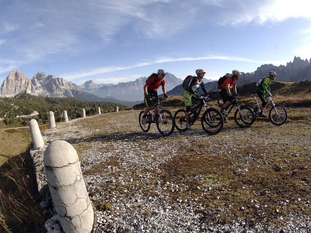
Mountain Bike - Great War Tour 2 (Alleghe)
We set off from the centre of Alleghe on the busy provincial road SP203 and reach the village of Masarè; once across the bridge we turn right and head towards Saviner pedalling along the asphalted community road, looking out for the short climb at the height of Villa Paganini and then downhill to the lake to then climb back up to Saviner; we go down a short little lane which at first is a bit harsh due to the gravelly surface but then ends after a few metres on the bicycle path that coasts along the Cordevole until Santa Maria delle Grazie. We take the asphalt in the direction of the village cemetery; here we take the little dirt road on the right continuing to pedal on a false plain for a few hundred metres; pay attention to the short descent with a slippery gravel surface, then we go back to riding along back up the Cordevole to Savinei , continuing on the same run we arrive with a few up and downs to the village of Pettorina. From here on asphalt on a slight climb in the direction of Sottoguda passing through Sorarù, Col di Rocca and still pedalling on the bike path we arrive in Sottoguda with the last metres on dirt road; a brief climb and we are just above the hamlet; we turn right and immediately left to cross the village, after which we enter the Serrai di Sottoguda which has been the stage for many editions of the Giro d’Italia, a real canyon with an easy start that is easy to ride while becoming a bit more difficult towards the end. We have come to Malga Ciapela and we pedal on the asphalt of road 641 for 2.5 km until we arrive at the chair lift that will take us up to Passo Padon. Back on our bikes we descent along the path that then becomes a little dirt road and then a path again for a little more than 2.5 km to the point in Mesola; we climb back up for 1 km on an old mule trail until we are under Col Vescovo (2348 m). We continue a descent on dirt road marked 680 until it joins with state road SS48 that goes down from the Pordoi, a tract about 1.8 km long on asphalt, then from Ru de Pordoi we take the dirt road on the right all the way downhill to the parking lot for the Arabba lifts. We go back to the asphalt on the state road for a little less than 4.5 km to the junction on the left towards Cherz and Malga Cherz which we reach by climbing a dirt trail for 1.5 km and continuing up for 2.5 km we arrive at Passo Incisa. Passing this we continue downhill towards the waypoint in Freines and then the last km on asphalt until Corvara Rutort to continue to the point at Piz dal Ander and almost flat for 1.65 km to l’Utia La Brancia. We set off again with about seven hundred metres of up and down until we arrive at the Rifugio Bioch, we continue for another 600 m of up and down to Pre de Raus to then take a climb of 600 m up to Pràlongia; we continue downhill until Pra de Sare for more than 5.5 km all on a fast, fun dirt road, followed by a short rolling section to then start climbing again almost right away towards Malga Valparola; right after passing this we take a short asphalt stretch to go back up to Passo Valparola and come off the back of the pass down towards Passo Falzarego. After the pass we take the downhill on regional road SR48 for a little more than 4 km until the curve where we will turn right for Bai de Dones and the chair lift that will bring us up to the rifugio Scoiattoli in the shadows of the 5 Torri. We get off the lift at rifugio Scoiattoli (2255 m); here you can visit the recently restored war trenches where during the War the Italian Command of the Mountain Artillery Group were entrenched to control the lines of cannons pointed against the Austrian outposts located at Lagazuoi and on Forte Tre Sassi at passo di Valparola. In memory of these tragic events, ex soldiers established what is perhaps the largest museum in terms of surface area commemorating the First World War, consisting of the open sites at Forte Tre Sassi, Sasso di Stria, Lagazuoi and 5 Torri. We start pedalling again, going up from the 2255 m at Rifugio Scoiattoli towards Forcella Nuvolao at an altitude of 2416 m; the climb is decidedly hard, both for the inclines which touch 15% as for the difficult, tricky surface, so these will be 1000 very challenging metres to cover. We start off once more from the most scenic and also the highest point on our itinerary, descending along the gravelly ski slope with a complicated, bumpy surface; we leave this difficult tract after about 120 metres to take the path on the right marked 441 and we follow this in the shadows of the Averau to waypoint “Pre da Pontin”, a rocky path for 1.2 km and -156 metres of altitude change. At the junction we take the left on the path that will take us down another 110 m of altitude change for a little over 1 km until we arrive in Melei (2142 m). We can expect a charming, articulated tract that is 5.57 km long with 54 metres rise in altitude and then a drop of -523 which will see us pedalling under the monte Pore on a rocky route that winds partially through the woods and mostly up and down, we will follow the ancient road – the "Strada della Vena" to Col (1672 m) to continue on a path that is asphalt for the first section, descending towards Colcuc with 2.22 km and -146 m with an average drop of 6,5%. We continue along the wild pastoral dirt road to the next waypoint at Sfessura about 1700 m away after some up and down; here we turn right and continue on towards Canazei in the territory of Colle Santa Lucia a little less than 1 km away downhill for -135 m. We continue our pleasant but intense descent towards Col de Foa and under Villagrande we take the path with a challenging gradient of about 15% that in no time will take us the 2 km to arrive to the next point with a brief tract on asphalt and then partly on a white road in the woods. We cross the asphalted main road and continue taking the path for about 1 km. On a woodsy dirt road with an incline of about 14% to arrive in the village of Caprile which we will leave behind us and pedal along the Cordevole for the final 4 km. On via Nazionale or regional road SR203 to the outskirts of Alleghe where we will turn right to pedal along the lake towards the centre of the village.