Mountain Bike - Gravity Marathon (Alleghe)
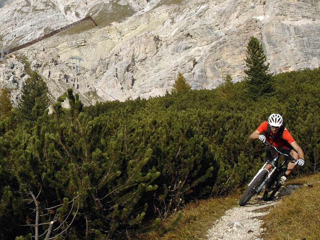
Start off from Alleghe and take the cable lift to Piani di Pezzè (1451 m), then pedal to Fontanabona (1462 m) with the namesake refreshment bar, we pass this point to head towards our destination: "Col de la Meda"; this 1.64 km long section has a negative altitude change of -345 m that brings us to our target at an altitude of 1130 m; we pedal along a ski slope, a rocky path and forest access road taking on a 21% gradient on a fun stretch which however merits caution. We continue going down for a brief tracts, about 40 m towards Fontanive (1046 m) with an altitude change of - 84 m on a path alternating with asphalt towards the village. We will cover the last 730 metres alternating between dirt road and asphalt to conclude this first step in the descent that will take us to the 970 m at the Alleghe cable lift. We head off again towards the second step in this “Gravity Marathon” from Alleghe, riding up to Piani di Pezzè on the cable lift and we reach the second chair lift a few hundred metres away that will carry us up to scenic Col dei Baldi (1915 m) and facing South we go downhill to the right for about 0.55 km, and at the junction for Col Fioret we turn left and in a few hundred metres we arrive to Prà della Costa (1630 m), continuing down for Val d’Aier for about 1.5 km with a quite challenging negative altitude change of -205 m, a descent with a couple of very technical and tricky stretches. Having passed th “Strente” point, we head to our next objective, “ the village of Fernazza” about 1.4 km away with about -70 m of altitude change, we continue downhill on the same path and after having covered about six hundred metres we get to the hamlet of Coi. We continue the descent towards Alleghe; it is fun but also quite challenging because it is rough, then we find the asphalt until we pass the conglomerate of houses in Frena and then arrive at Coldemies about 1.15 km away with a negative altitude change of 17 % for the most part off road and then on to Fontanive where we arrive with – 207 m at 1140 metres (- 18%) in a show of the commitment we will have to have on the route that presents asphalt as well as dirt road, we have to pay attention when crossing the community road. Now we are in the final stretch; there are just about 700 metres on a 9% downhill between asphalt and dirt road to arrive; the arrival is always back at the cable car which we will take for step 3 of the gravity ride. Col dei Baldi is always our destination with the lifts; from here facing South we go down for about 500 metres and when we come to the junction for Col Fioret we take the left to arrive after about 100 m. to the Prà della Costa. From here we have to commit to an uphill climb that is partially on a ski slope for about 1.2 km and 108 m of altitude change until we reach Costa del Conte (1933 m). We take the downhill for 0.75 km on a rocky path with certain slippery points until we come to the chalet rifugio Fertazza, we pass it pedalling for another 100m towards the lift that will take us up to Belvedere di Fertazza, where we find the refreshment bar of the same name. Leaving the lift to our backs we take the right towards Cima Fertazza (2099 m) following the trail marked 566 towards Col di Davagnin (1922 m) and covering a challenging path of 1300 m on a rough downhill with a 16% incline we continue downhill, paying close attention to this stretch that has an incline of 27%, we go down the path for another 1300 m with a negative altitude change of -350 m until we reach the village of Ru delle Sorize (1572 m). We're at the last leap towards the lake, we head down towards the houses in Piniè on a path that is mostly in the woods; we continue pedalling on the path towards Col di Fontana, we are in the last stretch with quite a challenging 18% gradient and after passing the Dorich houses we wind up in the village of Vallazza, a 3600 m leap with a negative altitude change of 625 m and just 24 m of climbing with an average negative incline of 17,5%. Now we are on the outskirts of Alleghe, another five hundred metres to arrive at the main village for which we take a lakeside path and another couple hundred metres to pedal as we enjoy the view of the calm verdant waters of the lake until we arrive to the cable lift. We are at the fourth step of this Marathon and we repeat the process we have come to know well until we reach the summit at Col dei Baldi: we leave from Alleghe going up to the Piani di Pezzè with the cable lift and from the parking lot we get to the second chair lift just a short distance away that will take us back up to scenic Col dei Baldi (1915 m), getting off the lift we face South and take the downhill to our right for about 550 m to the junction for Col Fioret, heading straight down for Malga Boi Vescovà being careful in a short, steep stretch with a slippery gravel surface. After this we ride along asphalt for about 450 m which will bring us to the junction for Casera Fontanafredda; we take the left and pass the dairy, pedalling along an easy and short climb towards F.lla Pecol; after coming over this we head down hill on a challenging technical tract for about 2 km and a 15% negative incline until we reach the point at Vizza Mareson, we take the left on a dirt road and then asphalt to cover a 500 metre stretch under the forest called Bosco delle Foglie. When we come out we are just a few hundred metres from the asphalt on state road SS 251 to the Pescul chair lift. We go back up to Fertazza using the lifts and we find the refreshment bar of the same name, with the second section of chair lift we arrive at 2082 m on the scenic Belvedere di Fertazza with its refreshment bar. We take the right to go back up a few metres to Cima Fertazza, then descend on path marked 566 in the direction of Col di Davagnin, a challenging section about 1300 m long with -180 m at 14%. Continuing along the 566 we keep to the path with a surface that is not easy and a few ups and downs through a thick, shady forest; this section has a negative altitude change of -671 m with some decidedly harsh passages, and then we are at the hamlet of Lagusello (1251 m) where we will also find some asphalt. We continue along the path on our steep descent along trail no.566 with another - 250 m and a 20% incline towards the village of Fiorentina which is located just outside the conglomerate of Caprile on the provincial road SP20, on the asphalt we take the left to get to the junction that will merge with Via Nazionale and asphalt. At the crossroad we take the direction of Alleghe following the Cordevole torrent to the next point which is the bridge Ponte sul Cordevole; from Col di Davagnin to this point we have covered about 8 km pedalling uphill for a few dozen metre with a negative altitude change of 959 m with an average descending incline of 12%, we are now in the village of Alleghe, another 400 m and we go right onto a lakeside bike path, pedalling the final 500 metres along the lake to conclude our day in Corso Italia.